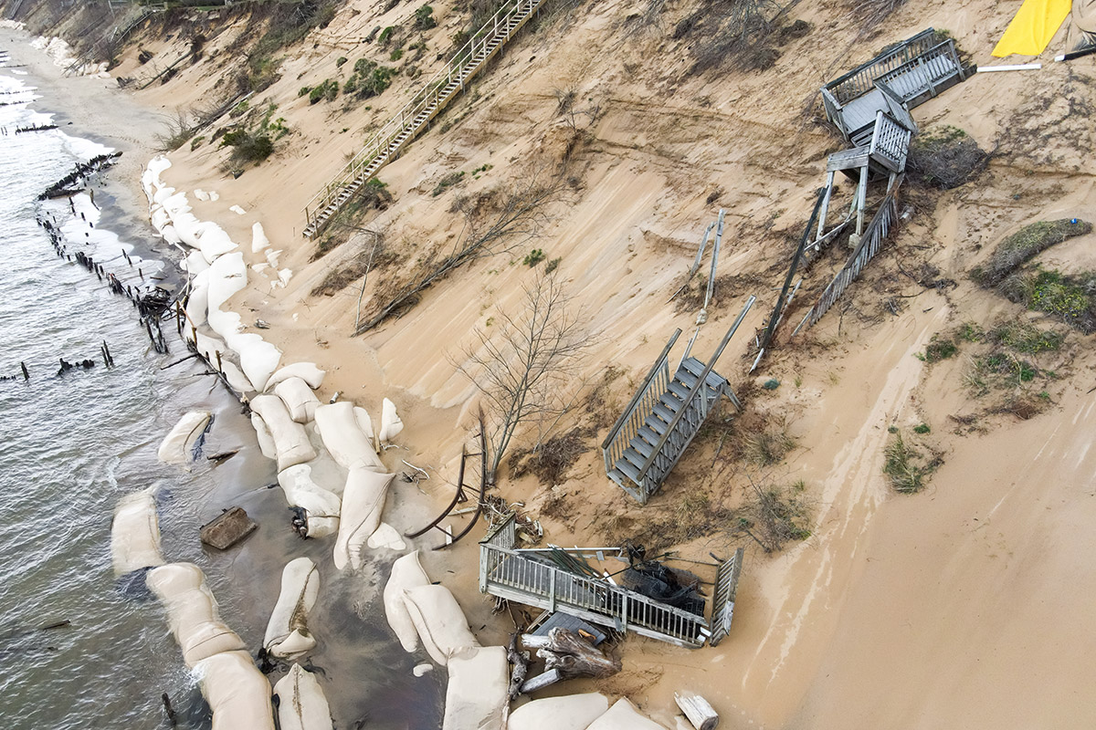
 Aerial view of damage on eroding dune on Lake Michigan. Photo by Sarah Rypma.
The impacts of climate change on the Great Lakes are manifesting as intensified precipitation, heightened evaporation rates, diminished ice cover, and increased variability in water levels. These phenomena pose significant dangers to essential resources such as drinking water, groundwater recharge, shoreline integrity, coastal infrastructure, and the habitats that sustain fish and wildlife.
Recent occurrences of record-high lake levels have resulted in severe erosion, substantial property damage, and widespread flooding. Simultaneously, longer-term forecasts indicate increasing extremes in lake levels, oscillating between unprecedented highs and lows. The warming of winters is leading to a decline in ice cover, consequently leaving shorelines vulnerable to intensified wave action. In addition, heavier rainfall events contribute to increased nutrient and sediment runoff, which exacerbates harmful algal blooms and places additional strain on municipal water systems. Furthermore, groundwater systems, which are hydrologically connected to the lakes, are at risk of altered recharge dynamics and contamination during flood events. Existing policies rooted in historical hydrological data fall short of addressing these pressing challenges posed by climate change.
Existing policies rooted in historical hydrological data fall short of addressing these pressing challenges posed by climate change.
Policy recommendations
Given the inadequacy of current policy frameworks, a new approach is needed—one that anticipates future conditions rather than reacting to past patterns. Four key strategies have emerged, each designed to strengthen the region’s capacity to adapt to an increasingly volatile climate.
1. Require climate-informed planning
It is imperative to revise floodplain maps, shoreline zoning regulations, and infrastructure designs by incorporating climate projections and dynamic lake-level modeling. For example, the city of Rotterdam in the Netherlands has integrated climate projections into its urban water management strategy, using adaptive flood defenses, water plazas, and updated flood-risk maps to manage rising sea levels and extreme rainfall. Chicago integrates climate projections into coastal planning along Lake Michigan through its Climate Action Plan and shoreline management strategies, which guide the design of lakefront infrastructure, stormwater systems, and flood-resilient parks to address rising lake levels and extreme storm events.
2. Enhance integrated water management
Foster cooperation in the governance of both surface water and groundwater across state and provincial boundaries, leveraging transnational relationships to ensure comprehensive management. The Great Lakes region is still falling short in truly integrating groundwater and surface water management, especially regarding nutrient flows, emerging contaminants, and the ecological impacts of groundwater withdrawals. Addressing these gaps requires better monitoring of groundwater-lake interactions, stronger cross-border data sharing, and policies that explicitly link groundwater management with surface water protections.
A notable international success in transboundary integrated water management is the Mekong River Basin, where the Mekong River Commission (MRC) coordinates water allocation, ecosystem protection, and hydropower development across China, Laos, Thailand, Cambodia, and Vietnam. By jointly monitoring river flows and conducting basinwide environmental assessments, the MRC addresses both surface water and connected groundwater impacts, such as maintaining groundwater-dependent wetlands and managing sediment transport.
3. Emphasize nature-based solutions
Prioritize the restoration of wetlands, dunes, and floodplains to serve as buffers against storm surges, mitigate runoff, and bolster groundwater recharge.
For example, projects funded through the Great Lakes Restoration Initiative—such as the Shiawassee Flats Wetland Restoration in Michigan and the Fort Sheridan coastal habitat restoration along Lake Michigan—have restored marshes, ravines, and dune systems that naturally absorb floodwaters, filter runoff, and enhance coastal resilience.
4. Commit to monitoring and equity
Expand the sharing of basinwide data and allocate resilience funding specifically to vulnerable shoreline communities and Indigenous Nations to promote equity in resilience and adaptation.
For example, the Great Lakes Observing System provides real-time data on water levels, temperature, and water quality across the Great Lakes, while programs under the Great Lakes Restoration Initiative have directed funding to projects in historically underserved shoreline communities and support Indigenous Nations in Michigan, Wisconsin, and Ontario to enhance local resilience planning.
Neglecting to integrate anticipated climate impacts into the policy frameworks for Great Lakes water and coastal management represents a significant governance shortfall, as seen in municipalities along Lake Ontario, Lake Erie, and Lake Michigan where floodplain regulations and shoreline infrastructure designs still rely on historical water levels rather than projected climate-driven changes. Embedding advanced climate projections into these policies is crucial for safeguarding water security, sustaining ecosystems, and supporting coastal economies amidst an era characterized by increasing hydrological instability.