The need exists for better mapping across broader areas within all large lakes of the world. Consider, for example, the Laurentian Great Lakes and their limited high-resolution bathymetry and substrate data. Estimates of coverage for the Great Lakes basin vary from 4 to 12 percent, lagging behind the 18-percent coverage achieved for the world’s oceans (Mayer et al. 2018). In fact, we have significantly more information at a much higher resolution for the surface of Mars than we do for either the Great Lakes or the world ocean. Such large gaps indicate a need for data collection strategies that streamline access, emphasize standards and competencies, and prioritize areas of need to benefit multiple user groups. New collaborative approaches combined with accessible data repositories and technological advancements can help move us closer to a well-understood Great Lakes basin, and may allow us to one day realize a complete and comprehensive view of the basin’s lakebed.
Seabed 2030 is a collaborative project between the Nippon Foundation and the General Bathymetric Chart of the Oceans. The project aims to bring together all available bathymetric data to produce a definitive map of the world ocean by 2030. A Lakebed 2030 project could similarly drive support and the development of strategies for obtaining 100-percent coverage for the Great Lakes. The Marine Technology Society collaborated with Northwestern Michigan College (NMC) in Traverse City, Michigan, to hold the Great Lakes TechSurge–Lakebed 2030 conference in October. Stakeholders shared their perspectives and experiences to better understand bathymetric lakebed mapping. They discussed current practices, new approaches, successful partnerships, and lessons learned, and they identified several challenges and opportunities.
From a Great Lakes perspective, fulfilling this vision of 100-percent coverage requires building capacity at local, regional, and international scales and further developing (or creating) collaborations that freely share collected data, technological advances, and workflow strategies. We must further classify, compile, and process these data into a robust and freely accessible digital repository that clearly defines existing coverage and data resolution. Gaps in data coverage could then be assessed and prioritized through continuing collaborations.
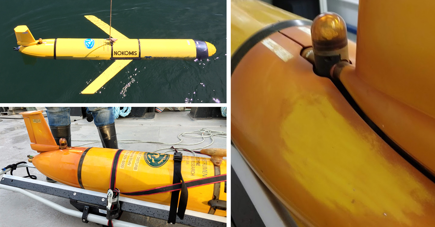
Advancements in technology promote new collection strategies for mapping the gaps, and they provide opportunity for innovative approaches in meeting these needs. Specifically, rapid advances in acoustic technology and robotics are leading to innovative approaches that maximize efficiency, resolution, and visualization of the entire Great Lakes and other water bodies throughout the world. Multibeam sonar data can provide a broad understanding of the lakebed bathymetry, substrate, and water column all in a single pass. Unmanned surface vessels, autonomous underwater vehicles, and long range sub-surface gliders now navigate all marine domains equipped with a wide variety of sensor packages. The use of these platforms extends data collection windows and requires significantly fewer personnel for operation. Further developments in unmanned aerial systems can capture nearshore environments at a much lower cost and faster response.
Recent mapping in the Straits of Mackinac included the use of multiple autonomous surface vessels virtually coupled to a manned survey vessel, which allowed for a near doubling of the swath of mapping coverage without requiring additional personnel or time on task. Data collection advancements like this have revolutionized our ability to comprehensively visualize the lakebed and water column. What began as single depth and position measurements taken by a lead line and sextant has evolved into massive amounts of data being collected in a single ping: multiple depths at decimeter resolution and highly accurate positions, identification of lakebed features, significant substrate identification, and complete water column coverage. The bathymetric mapping systems used today can collect data across multiple frequencies at swath widths of more than three times the water depth (as pictured above). This use of multiple frequencies provides multispectral backscatter return from the lakebed, with each return providing significant delineation in habitat classification and general lakebed structure. Staggering those frequencies during a single collection pass ensures comparability of the backscatter across all frequencies thus allowing the user multiple perspectives of the lakebed in a single transect.
Realizing a comprehensive map of the Great Lakes will require significant contributions from beyond the formal mapping and science channels. Integrating commercial off-the-shelf (COTS) mapping technologies into crowdsourcing opportunities represents an additional approach toward reducing the gaps in data coverage and accelerating the vision of Lakebed 2030. COTS technologies are improving in quality and accessibility, and could be used to outfit ferries, commercial ships, and recreational vessels to collect data during their normal operations.
A successful Lakebed 2030 project will produce a definitive map of the Great Lakes and, in so doing, will empower policy decision making, sustainable use of the lakes, and the scientific research that relies on comprehensive information on the Great Lakes.