Active hydroacoustics are used worldwide to estimate fish abundance, including in the Great Lakes. This technology uses sound waves to detect fish, much like a bat does to find its next meal. Current surveys are done at night from ships by research agencies in both the United States and Canada. Recent advances in drone technology now allow surveys with uncrewed vehicles to cover large areas and to operate both day and night. These autonomous drones can collect more high-quality, active-acoustic data than ever before with the crewed research fleet, providing unprecedented insights into the fishes of the lake and how the lakes function.
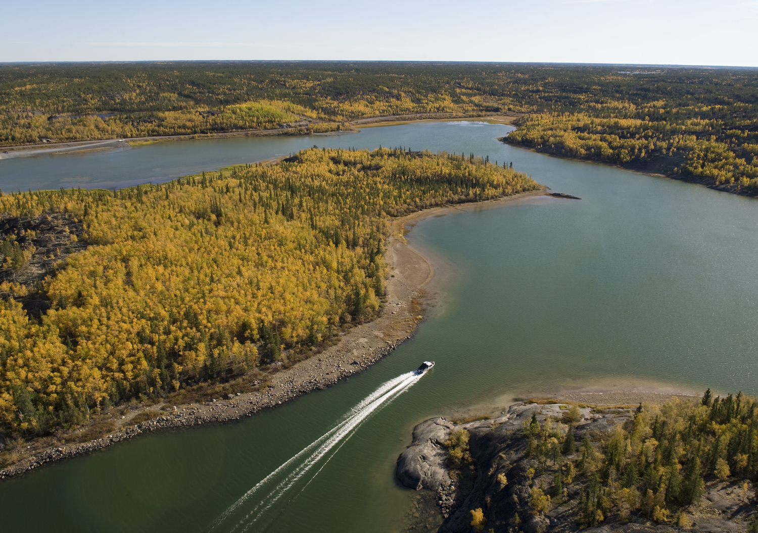
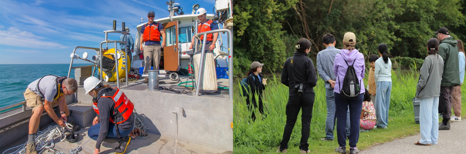
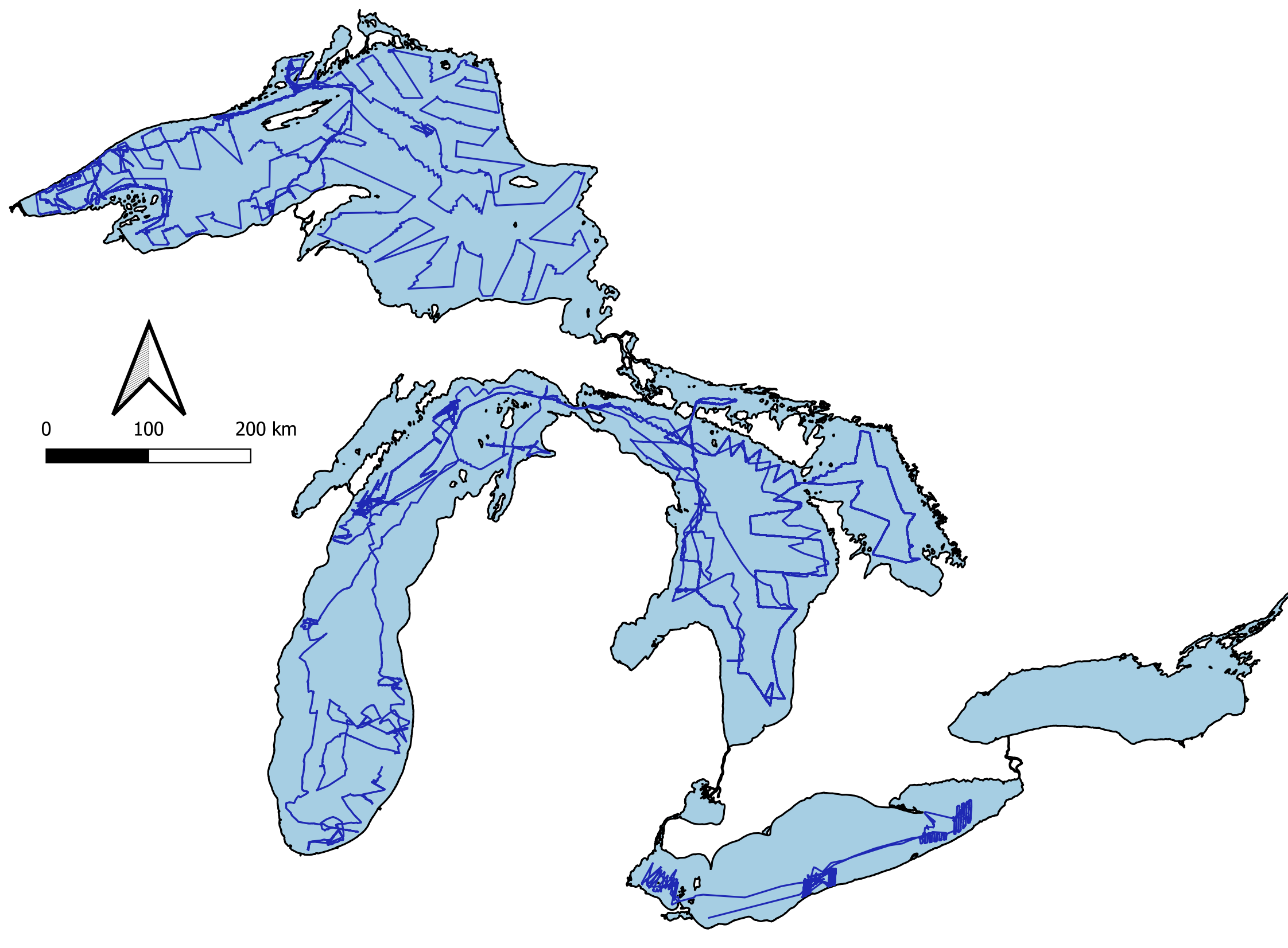
Through a collaboration with the United States Geological Survey Great Lakes Science Center and Cornell University, two of these new sampling platforms, pictured above, were deployed throughout four Great Lakes, covering more than 21,000 kilometers of sampling track—over half the Earth’s circumference—on lakes Michigan, Huron, Erie, and Superior (see figure at right). One was an uncrewed surface vessel developed and operated by Saildrone Inc. The second was a long-range autonomous underwater vehicle, developed by the Monterey Bay Aquarium Research Institute.
The surface drones are propelled by wind power and use solar panels embedded in the drone to charge batteries to power onboard sensors and equipment. This type was selected because they have no propellers, allowing us to test the hypothesis that motorized research vessels alert fish to their approach, causing them to flee. The drones’ lower noise levels also result in cleaner data and increase our ability to detect fish and even mysid shrimps at greater depths—as deep as 250 meters. We exlored fish avoidance of ships by comparing drone data with ship-based acoustics, finding that ship avoidance behavior is minimal (Evans et al. 2023, 2024). However, data collected from the underwater drone show that a substantial number of fish, especially smaller fish, are near the surface at night and are missed by surface-deployed acoustics. This type of drone travels underwater for long periods (several days), collecting hydroacoustic data with both upward- and downward-looking echosounders. It resurfaces at regular intervals to transmit data and receive new instructions before resubmerging.
"Two of these drones completed a whole-lake acoustic survey of Lake Superior, the first of its kind in the Great Lakes. "
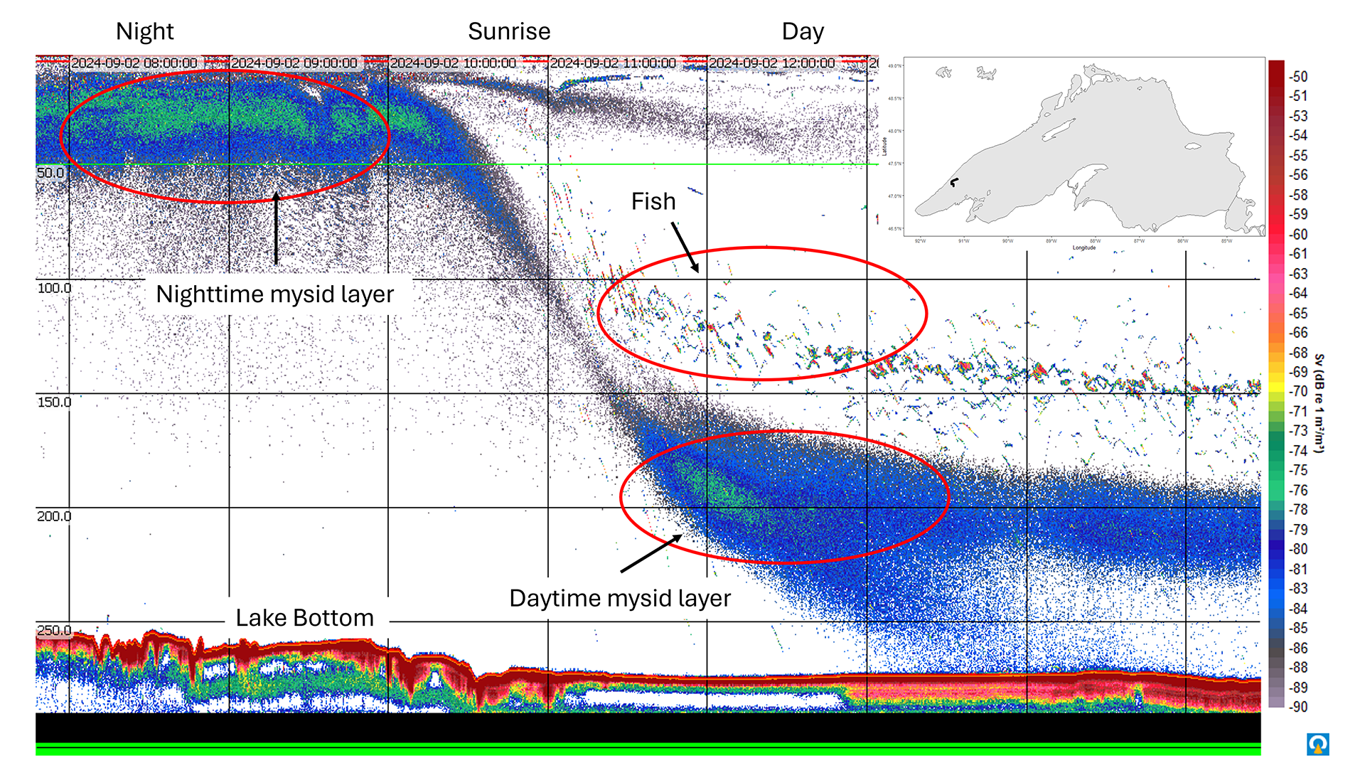
In 2024, we explored whether surface drones could gather data at a lakewide scale, in lieu of ships. Two of these drones completed a whole-lake acoustic survey of Lake Superior, the first of its kind in the Great Lakes. This survey collected data continuously for 45 days, providing a unique look at the daily migrations of fish and invertebrates. Daily migrations are a common phenomenon in ocean systems and known in the Great Lakes, but the 2024 data allowed us to look deeper than previously possible due to the quietness of the drones and the ability to survey both day and night.
The data reveal a routine daily migration of both fish and mysid shrimps spanning several hundred meters throughout Lake Superior, as illustrated in the figure above. At dusk, the Kiyi, a coregonid that specializes on feeding on mysids, ascends from a daytime depth of around 150 meters, followed by mysids that move with a preferred light level and visit the thermocline at night. The reverse happens at dawn, with mysids descending first, followed by fish. Because we can observe mysids deeper than before, we found that mysids form a 20- to 30-meter-thick layer in the water column around 200 meters depth, almost 50 meters deeper than the fish layer. Where water depth is shallower than 200 meters, mysids reside on the bottom, but even in 250-meter-deep water, some mysids appear to continue to the bottom rather than stay suspended. Whether mysids spend the day on the bottom has implications for the coupling between the benthic and pelagic zones in the Great Lakes.
These autonomous technologies provide a promising complement to conventional vessel-based surveys. By freeing crew time on already busy vessels, they enhance operational flexibility. Most importantly, they offer a way to increase spatial and temporal resolution in ecosystem monitoring, revealing patterns that were previously difficult or impossible to detect with conventional means.